Utah Excursion
Text by Matt - Pictures by Jenya and Matt
Jenya and I teamed up with friends and fellow seasoned backpackers Nat
and Mike for a week off in southern Utah, including a two-day trek down
the famed Zion Narrows. In order to maximize our time
and spare our vehicles, we decided to fly to Vegas and rent a jeep.
After getting tickets on Hawaiian Airlines we discovered, to our horror,
that we couldn't bring camp stoves in our luggage. We're not talking
gas cans - we're talking just the stoves without the fuel. So we had to
mail them in advance to a pre-determined hotel in Vegas.
Day 1 - Friday June 4th - Night Flight to Vegas
We all met at Oakland Airport around 8:00pm. It was a painless flight
into Nevada, arriving at midnight. While running through the Las Vegas
terminal I tripped and completely tore my expensive hiking shoes.
We were hoping to quickly get our jeep and head to the hotel,
but the computers were down at Dollar Rent-a-Car and the line out the
door was moving very slowly. After 30 minutes, we estimated we wouldn't be
getting to the head of the line until 2:30am. All other rental car
businesses were closed for the night. Note to self: Flying to Vegas doesn't
save you any time.
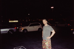
Nat with sarcastic grin waiting outside the rental car place. It's 1:00am and 90 degrees outside.
We finally got our jeep and made it to the hotel around 3:00am and
loaded into our room. Since we weren't going to get any sleep tonight
anyway, we stayed up and roamed around the casino downstairs and got
some cheap late night brunch before getting some shuteye. The air
conditioner in the room made random noises at volumes even my
earplugs couldn't mitigate. So this wasn't the best way to start our
vacation, but it only got better.
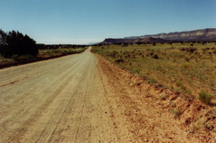
Day 2 - Saturday June 5th - On to Zion
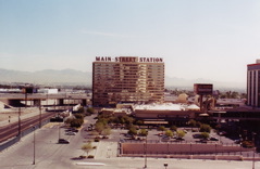
View outside our hotel room. This has got to be one of the ugliest cities on the planet.
We woke up at 8:30am (ugh) and got on the
road to Springdale, Utah - the lovely little town right outside
Zion National Park. The drive is only three hours. We hit the equipment
shop that sells 5.10 Canyoneers - waterproof hiking shoes that were
made specifically for the Zion Narrows (and likewise mixed terrain).
Jenya, Mike, and I were psyched enough to actually buy our own pairs. I ended
up being the only one who finished this trip 100% pleased with my purchase.
Nat had some misgivings and rented his pair, which saved him many dollars, but
they smelled like rotting fish. The storeowners let us borrow long wood
staffs for the Narrows hike. We thought this was silly at first
but turns out they totally saved our asses - they were much more sturdy/stable
than our wimpy hiking poles.

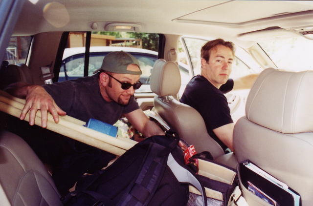
Nat and Mike in the (packed) jeep with the recently obtained wooden staffs.
We checked into the backcountry office and got all our permits for the
trek tomorrow squared away. Had dinner at Pizza Noodle in Springdale.
Also stopped in the Fatali photograph gallery depicting amazing
views of the southwest. We were mesmerized by one photo containing
white mushroom-like formations - the caption said these were in the
south part of the Escalantes. Hmm. Then headed to our reserved spot
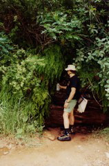
in Watchman campground. Took a brief hike as the sun set
and then set up for the night.
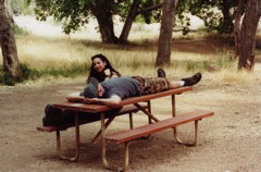
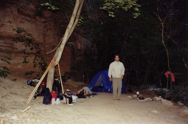
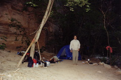
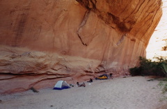
Jenya and Nat resting it up at camp.

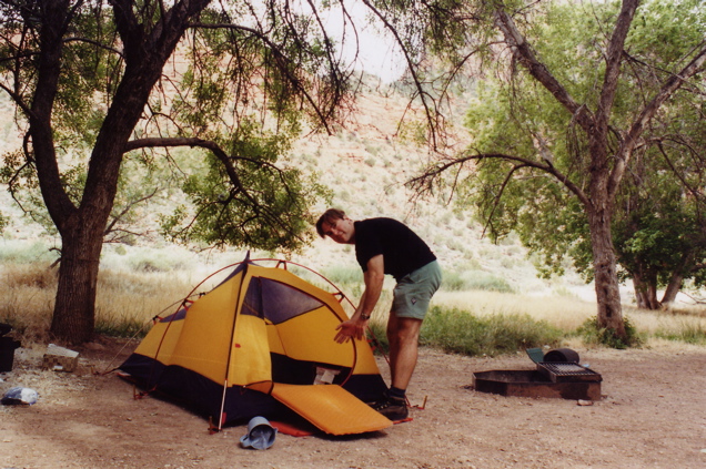
Mike setting up his new tent.
Day 3 - Sunday June 6th - Into the Narrows
Got up at 7:00am, deflated thermarests, packed tents, etc. Parked in
the visitors center where we were to meet our shuttle driver
to take us to the top of the Narrows. Jenya kicked the trunk of the
jeep closed, leaving a large dent in the door. Met our
friendly driver Bry (sp?). She was born and raised in the nearby
town of Virgin and had interesting insight on Utah/Morman culture -
an interesting conversation topic which ate up most of the long
and scenic drive. She dropped us off at Chamberlain's Ranch
where we started our hike around 11:00am.
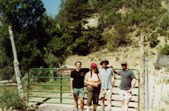
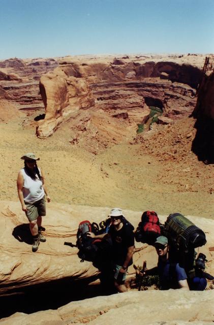
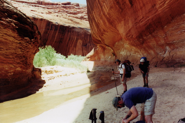
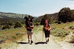
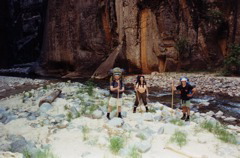
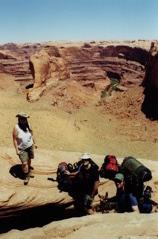
Group shot at the trailhead (left to right: Mike, Jenya, me, Nat)
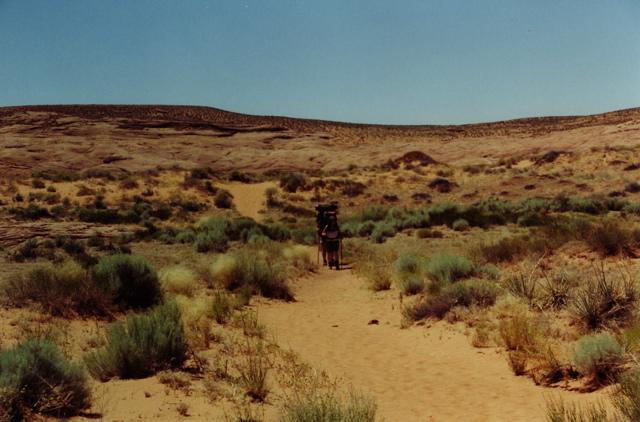
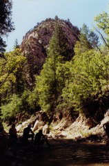
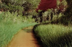
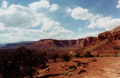
The first few miles offer nice, bucolic vistas, but are flat and high in sun exposure.
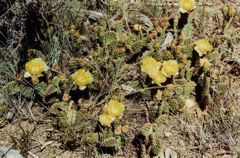
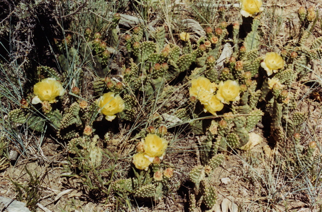
Desert flora.

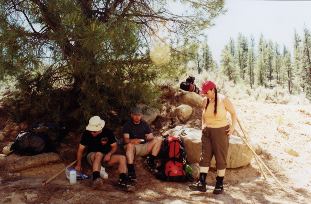
Stopping for lunch in some hard-to-find shade.
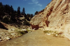
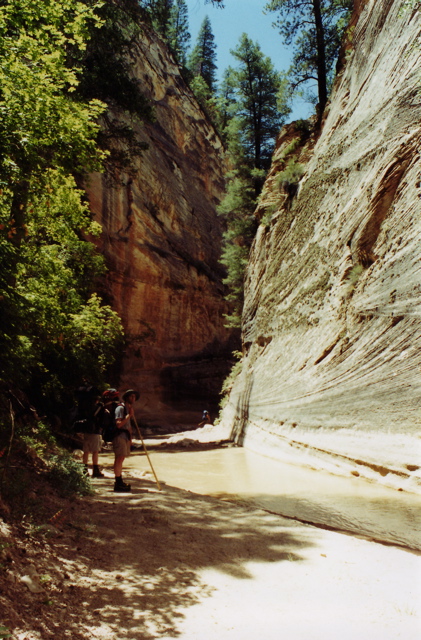
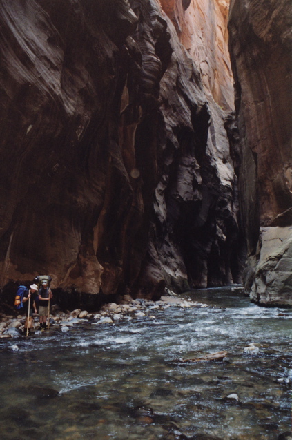
Finally meeting up with the Virgin river. As you can see, the trail is starting to dip
below the surface and will slowly become more narrow as we press on.
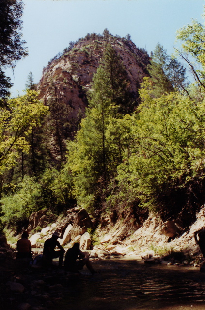
Mike inspecting a side canyon.

The narrows slowly deepen. Water crossings will become more frequent and tricky.
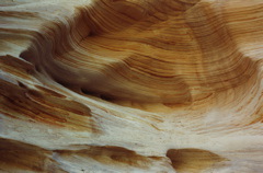
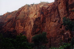
Interesting geology.
Stopping for another lunch in the shadows. It's slow going and quite tiring,
and we're falling behind schedule.
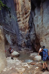
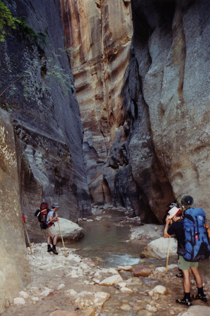
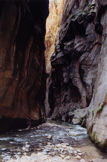
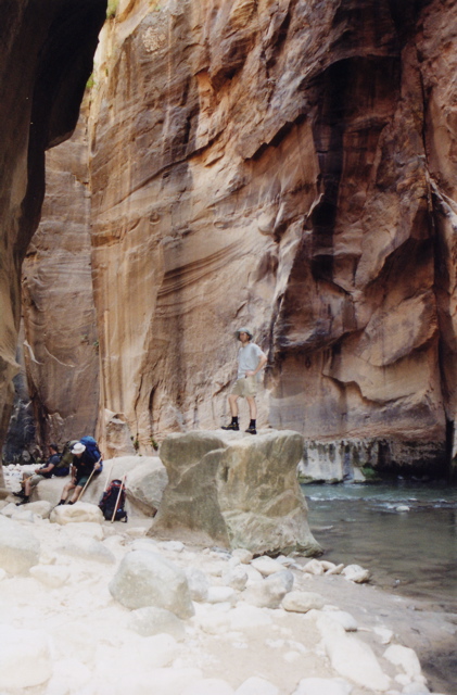
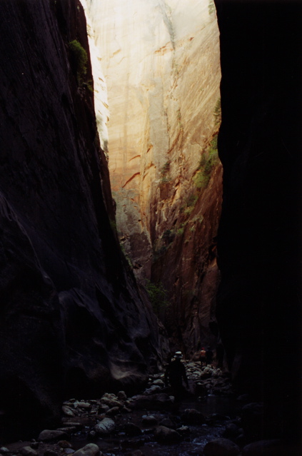
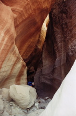
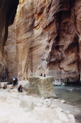
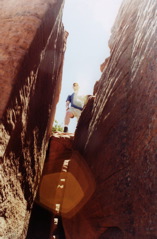
Some real narrows. If a flash flood hits now, we're screwed.
We reach the waterfall landmark, about six miles in. You don't have to jump down -
there's an easy path off to the side.
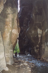
More narrows. These walls are quite tall and impossible to capture in a single photo.
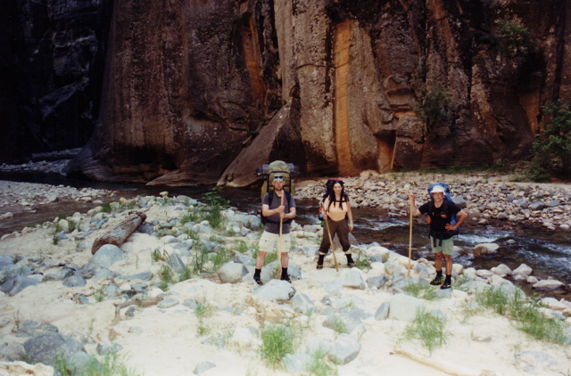
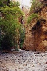
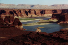
The confluence with Deep Creek. Hooray!
At this point we haven't dealt with water more than knee deep. With
the additional water from Deep Creek, the river will be colder, faster,
and occasionally waste deep (or more if you're not careful). At points the
current is so strong that you can't see the rocks beneath the surface.
Keeping your balance requires major effort - this is where the wood
staffs came in handy. Anyway, this landmark meant our campsite (at
the confluence with Kolob Creek) was only about a mile away. Phew.

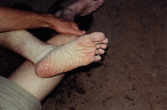
We reach camp and I immediately take off my Canyoneers. What happened to my
feet?!
Mike at the camp. It got cold as night fell.
Beans and rice for dinner. We were so hungry that we ate it all and
were still famished. Luckily Nat brought pancake mix (and syrup), so
we had those for dessert. Yum!
Made a poor-man's food hang made of our wood staffs, filtered a bunch
of water, and crashed to sleep.
Day 4 - Monday June 7th - Out of the Narrows
Kolob Creek canyon near our camp site. Obviously running a bit dry.
Over breakfast Nat, who slept outside without a tent, informed us that
he saw a ringtail last night trying to get into our packs, but he scared
it off. I noticed my suntan lotion was missing. We found the bottle later
at the edge of our camp site and covered with tiny bite/scratch marks.
We suited up and continued down the river. Lots of sketchy river crossings
and hunting for correct routes over boulder jams.
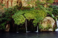
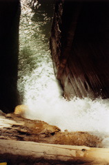
First noteworthy feature: Big Springs. It's like a small Hawaiian oasis.
After this is two miles of continuous narrows with no safe ground in
case of flooding.

Some of the aforementioned endless narrows. It's spectacular stuff, and
not as claustrophobia-inducing as one might think.

More narrows. Mike and Nat plan another questionable river crossing.
You basically have to zig zag from one side of the canyon to the other,
lest you discover a sudden drop and end up swimming.
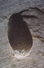
Cool feature in the wall - a hole carved out in which pebbles
collect after recent floods.
Taking our second or third lunch break. I climb an oddly square boulder.

One last particularly dark and mysterious section.
We finally reach the confluence with Orderville Canyon and take a short
side trip to check it out. It's much skinnier and muddier. We're too tired
and don't go very far. We have two miles of narrows left yet. The canyons
are now clogged with hundred of tourists who came up from the south to catch the
more easy-to-reach sections - lazy cheaters.
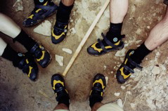
Our now well-worn Canyoneers.
The last two miles contain some of the best scenery, but we didn't take
any pictures as there were too many humans around. We just pressed on
to the edge of the park, pushing past the lowly tourists with our big
backpacks, feeling like a bunch of badasses.
On the mile-long walk from the river to the shuttle bus stop.

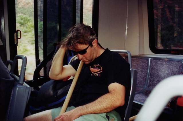
Mike crapped out on the shuttle back to Watchman campground. We all did, actually.
We just hiked over 16 miles in mud and rushing water for two days with heavy packs on.
We got our jeep at the visitor's center and noticed all the flags were at half mast.
Eventually we were informed that Ronald Reagan died.
We claimed a tent site and then went straight into Springdale for big fucking
burgers and ice cream. We earned it.
Day 5 - Tuesday June 8th - Travel/Rest Day
Since our bodies were in bad shape, we had a change of plans, delaying our
Escalante trip by a day. Instead we packed up and took a driving
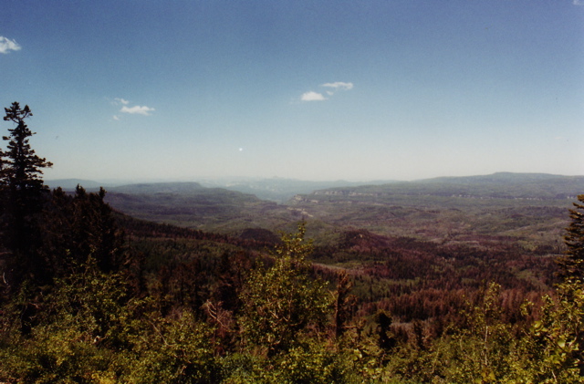
tour of the near vicinity, heading up I-15 towards Cedar Breaks.
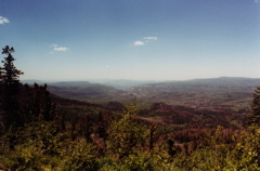
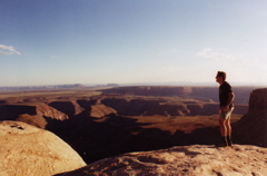
Suddenly at 10000 feet above sea level, looking southward towards Zion National Park.

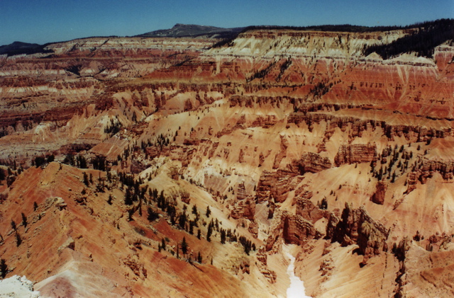
Cedar Breaks. Kind of like Bryce Canyon lite.
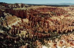
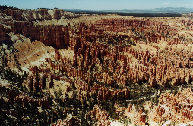
A couple hours later, we're in the actual Bryce Canyon. Face it - it's completely phallic.
After toolin' around Bryce Canyon we headed to the town of Escalante.
At the supply store we borrowed a plunger which we used to successfully
pull the dent out of the back of the jeep. We then camped at the lake on
the edge of town for the night.
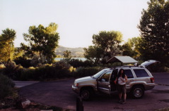
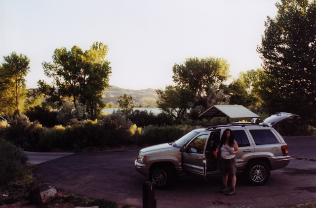
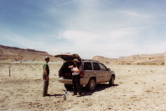
Jenya unloading the jeep, gettin' ready for some good ol' car camping.
We had a pasta dinner and would have had an enjoyable night of star gazing
over the lake, but a swarm of flies descended upon us, landing on us and
in all our food. We started a fire to smoke them out, but this didn't help.
Our only recourse was to flee to our tents and go to sleep early.
Day 6 - Wednesday June 9th - Back in the Canyon Again
Got our BLM permits and some breakfast in town. The cook at the food establishment
also runs an adventure guide business. He told us how he once spilled his
jeep going down Hole in the Rock Road and broke his jaw and clavicle.
It was four hours before anybody arrived to help him, and the nearest hospital
was even further away. We paid up and started our jeep going down
Hole in the Rock Road.

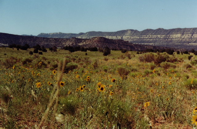
Pretty desert flora.
The road goes on like this for 40 miles. It was much smoother than last year.
The empty parking lot by the trailhead to Crack-in-the-Wall. We really are in the middle of nowhere.
The plan (descending into the canyons
of the Escalante River via Crack-in-the-Wall and hanging around for a couple days)
was basically the same thing Jenya and I did last year, and what
Mike has done about a half dozen times before. It really is worth
multiple visits.
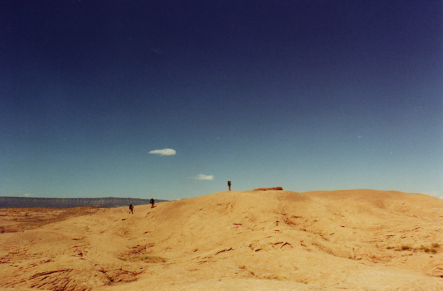
But first, a couple miles across hot, exposed desert.
Then up and down many petrified dunes.
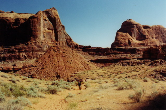
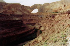
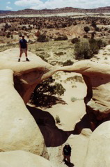
Made it to the rim! This is the crack down which you can easily drop into
the canyon which goes down about 600 feet to the river. It's hard to
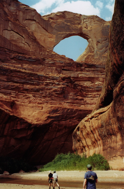
make out, but that's Stevens Arch in the distance.
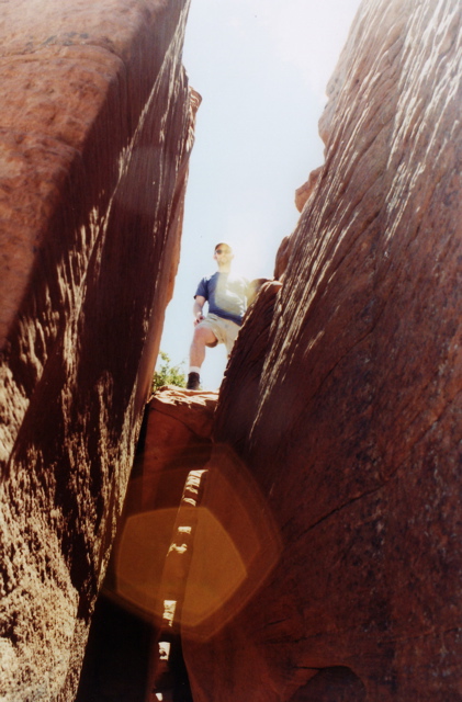
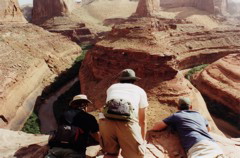
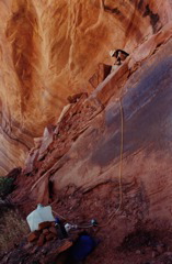
Nat was the last one down the crack.

We made it down the giant sand hill and plopped into Coyote Gulch.
Coyote meets up with the Escalante and we hiked in knee-deep water for
a half hour to our camp site. It was getting late in the day so we
quickly got our day packs together for a fast climb up into Stevens Arch.
Heading back around to the arch.
We're gonna climb up there?!
Basically, there's a scramble up loose sand and rock around the bend.
It's pretty sketchy, as the path is steep and eroding beneath our feet, but slow and steady wins the race.
Halfway up the scramble.
Looking over the edge at the meandering canyon just beneath the arch.
Over to the left it looks like there was a rock slide going into the river.
That's what we climbed up.
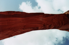
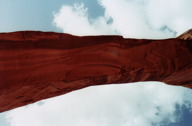
Underneath Steven's arch looking up. It's about 200 feet across. It's huge.
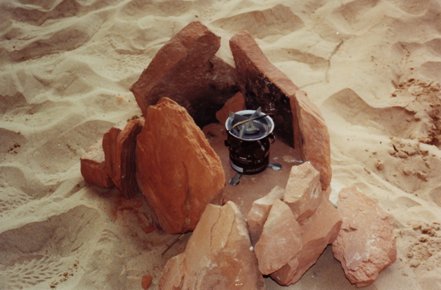
We were being knocked over by insane wind up there so we soon worked
our way down. Even back at camp the wind was intense. We had to
put some effort in protecting the stove from strong gusts so we could
make dinner.
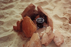
Stovehenge.
But as night fell the weather calmed and we enjoyed an amazing meal.
Jenya boiled up a pot of spicy and delicious beans n' rice. We followed
this with hot chocolate and then vodka/tang mixers.
Day 7 - Thursday June 10th - Coyote Gulch
Morning at our lovely camp.
Mike rigging up his automatic water filtering contraption. When we return
from our day hike, we'll have five gallons of clean water.
After breakfast we embarked on a 13 mile there-and-back trek up and
down Coyote Gulch. It was in the gulch that we suddenly
came across the first humans, shortly after Mike loudly announced
how the sphincter is the most amazing muscle in that it can
immediately differentiate between three states of matter.
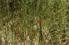
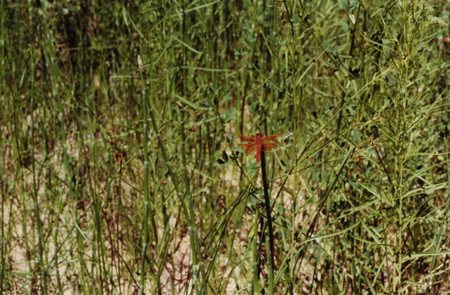
Big orange Dragonfly. There are blue ones around here, too.

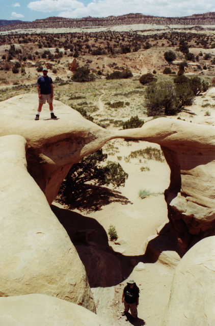
Cliff Arch (on the left). Also called "Jughandle" Arch. This was about as far
as we made it last year.

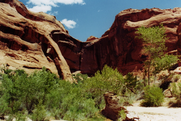
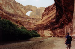
Continuing on through Coyote Natural Bridge.
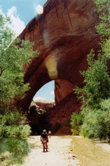
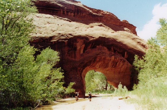
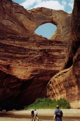
And finally Jacob Hamblin Arch. We shall soon park it and rest for a while.
Filling up our bottles at the bountiful spring.
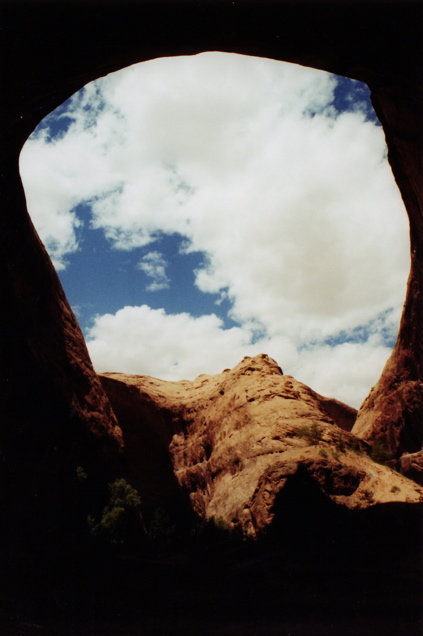
Jacob Hamblin Arch actually juts into what is the most amazing natural
ampitheatre I've ever seen. This is where we ate lunch and took a little
nap before returning. Last time Mike was at this very point a freak
flash flood broke out and he was trapped for the night with little food
and had to slog back in quicksand the whole next day.

View from inside the ampitheatre. Wowza.
Typical terrain in the gulch.
Back at camp Jenya whipped up some delicious Thai food - the secret was powdered
coconut milk and home-dehydrated veggies. Very few people eat such incredible
cuisine in their own homes, much less on a sand bar in the middle of the desert.
Day 8 - Friday June 11th - Road Trip
In order to avoid too much exposure on the difficult hike up sand on the way
out, we got up at 5:30am and braved splashing through the cold Escalante
waters to get to the crack before the sun reached over the cliff. I poorly
paced myself up the hill and wore out early on.

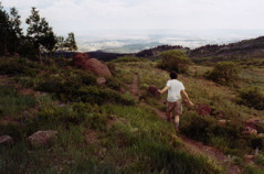
Slow going up the hill.
We finally made it to the lot, piled into the jeep and headed up Hole in the Rock,
stopping only to check out a set of weird rock formations called Devil's Garden.
Nat and Jenya at Devil's Garden.
All week long Jenya and I were going on about the incredible view at
Muley Point. Nat and Mike grew incredibly curious. So even though it
meant a significant amount of speedy driving to get to the this
magical place in the southeast corner of the state before sunset, we went for it.
Pedal to the metal, my friends.
A short break near Boulder Mountain. The high altitude makes me run like a girl.
Scenery from the highway.
Yet more scenery. Utah just doesn't stop delivering the goods.
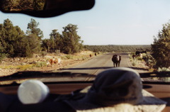
This ornery cow refused to budge. I honked and it just chewed its cud and stared.
I eventually steered into the other lane to drive around it.
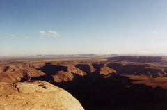
We made it to Muley Point with sunlight to spare. Oh, glory of glories! Oh, sweet testament to the
majesty of God's creation! That's the entire Monument Valley in the distance, and the deep
canyons of the San Juan River 2000 feet below us.
Mike was not disappointed.
We headed down into Mexican Hat for the night, eating some southwestern food
and getting a cheap ass motel room. Ah, to sleep in a bed!
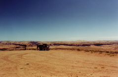
Day 9 - Saturday June 12th - Unexpected Miracle Trip into Wahweap Wash
Part of the motel deal was free breakfast in the adjacent restaurant. Sweet.
We then drove into Kayenta and wasted a lot of time buying shipping goods
and waiting for the post office to open so we could mail our camp stoves
back to ourselves. We ended up going through Page, AZ and was driving past
the southern side of the Escalante National Monument when Jenya spotted
the ranger station. We stopped in to collect info regarding a future trip
through Buckskin Gulch.
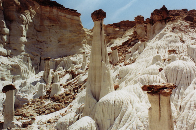
While there Jenya remembered about those funny white mushroom-like formations
we saw in that Springdale photo gallery. We asked the ranger and he told
us how to get to these "toadstool hoodoos." On the way out of the station
I happened to spot a photo on the wall with the caption "toadstool hoodoos."
The picture had nothing to do with the white formations we were hoping to see.
But we headed onto some unnamed dirt road reaching into a hidden corner of
this semi-protected land to find these things anyway, under the assumption I was
wrong about the picture I just saw at the ranger station.
Suddenly there was a fork in the road. Which way should we go?
Out of nowhere a park ranger appears.
I've never seen a ranger anywhere else in the Escalantes, but there he was,
and we asked him where to find the weird white formations.
This guy really knew what we were talking about, and gave us a map with
explicit directions to Wahweap Wash where they were located.
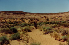
We pushed further into the bowels of this barren land. The temperature
outside quickly rose to 100 degrees. We had little water on us. Very often
passengers had to get out of the jeep to guide me inch by inch over some
particularly sharp and rocky sections. We had a plane to catch in Vegas
in 16 hours. This was not a well planned (or wisely chosen) adventure.
And we got lost again, unable to match landmarks on the map with the
landscape around us. Suddenly a trio of ATVs came roaring past us. One
stopped, recognizing our need for assistance, and gave us further clues
to find our way, and disappeared into the desert. We headed onward.
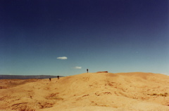
Near our destination. Now what?!
"Just park by the wire fence and walk a mile down the wash," the ranger
told us earlier. But there was great debate which way was "down." We
took an educated guess and selected correctly. A mile later and we
jumped for joy when the Wahweap Hoodoos appeared before us.

The garden of alien hoodoos. What planet are we on again?
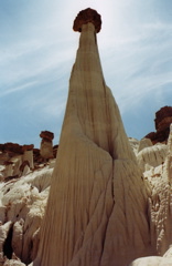
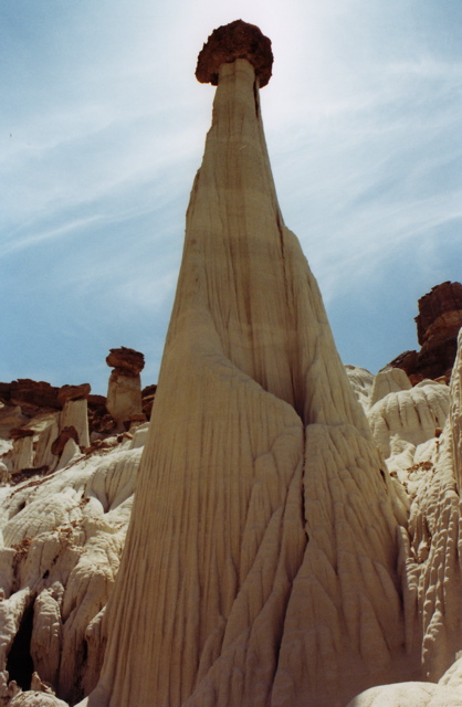
The biggest and most impressive of the bunch. I love its long, luxurious cloak.
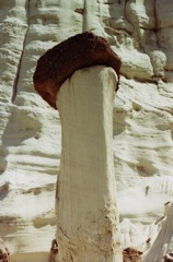
So basically these boulder "heads" protect the white sandstone from eroding in the rain,
thus forming these utterly bizarre and beautiful creatures.
Two hours earlier we had no idea what these things were called, much less
how to find them. But thanks to an improbable string of lucky events we
got to enjoy one last hidden Utah treasure before heading home.
We returned safely to the highway, drove up through Kanab and Zion and
finally into Springdale where we dropped off our wood poles and Nat's
rental Canyoneers and had bad Mexican food. With no other real plan we
headed to Vegas, figuring we can party all night in the airport before
our flight tomorrow morning. But unlike the rest of this crazy town,
the airport shuts down at night, and we had no choice but to sleep on
the floor. Fair enough.
The End!!
|